
Related Manuals for Kenwood DNN9330BTM


Summary of Contents for Kenwood DNN9330BTM
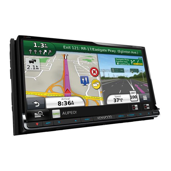
- Page 1 CONNECTED NAVIGATION SYSTEM DNN9330BTM GPS NAVIGATION INSTRUCTION MANUAL © IM365_Nav_M2_En_00...
-
Page 2: Table Of Contents
Contents Navigation End-User License Agreements Starting a Route Previewing Multiple Routes Following a Route Getting Started Using the Navigation Map Using the Navigation System Using Multi-touch Controls Help When You Need It Adding a Point to a Route Searching Help Topics Taking a Detour Status Bar Icons Stopping the Route... - Page 3 Using the Apps Customizing the Settings About ecoRoute Customizing the Navigation System Creating a Vehicle Profile Changing the Map Settings Resetting Your Vehicle Profile Enabling Maps Calibrating Fuel Economy Changing the Navigation Settings Taking the ecoChallenge Adjusting the Display Settings About ecoChallenge Scores Route Preferences Hiding Your ecoChallenge Score...
-
Page 4: End-User License Agreements
End-User License Agreements Software License Agreement suppliers) and affiliated companies on the other hand. BY USING THE DNN9330BTM, YOU AGREE TO BE BOUND BY THE TERMS AND CONDITIONS OF THE IMPORTANT: CAREFULLY READ THIS LICENSE FOLLOWING SOFTWARE LICENSE AGREEMENT. BEFORE USING THIS PRODUCT. INSTALLING, PLEASE READ THIS AGREEMENT CAREFULLY. - Page 5 HAVE BEEN ADVISED OF THE POSSIBILITY OF addition, you are prohibited from renting or leasing SUCH DAMAGES. GARMIN’S AND ITS LICENSORS’ the Data or the Garmin products containing the Data to any other person or third party. Only those TOTAL AGGREGATE LIABILITY WITH RESPECT TO ITS OBLIGATIONS UNDER THIS AGREEMENT rental car companies that are specifically authorized by Garmin in writing to rent Garmin products...
- Page 6 End-User License Agreements Her Majesty and Canada Post, shall not be liable in as (i) if applicable, your subscription term is either respect of any claim, demand or action, irrespective terminated (by you or by Garmin) or expires, or of the nature of the cause of the claim, demand (ii) Garmin terminates this Agreement for any or action alleging any loss, injury or damages, reason, including, but not limited to, if Garmin...
- Page 7 and all disputes, claims and actions arising from or in connection with the Data provided to you hereunder. Government End Users. If End User is an agency, department, or other entity of the United States Government, or funded in whole or in part by the U.S.
-
Page 8: Getting Started
Getting Started The first time you use your Kenwood Navigation System, you need to set up your system. The Help menu provides additional information. Help When You Need It WARNING See "Safety Precautions and Important Information" Select Apps > Help to view information in the Quick Start Guide for product warnings and about using the device. -
Page 9: Satellite Signals
Adding a Shortcut Satellite Signals You can add shortcuts to the Where To? menu. A After your vehicle is turned on, the navigation shortcut can point to a location, a category, or a system begins acquiring satellite signals. The search tool. The Where To? menu can contain up to system may need a clear view of the sky to acquire 36 shortcut icons. -
Page 10: Finding Locations
Finding Locations The navigation system offers many methods for finding locations. The detailed maps loaded in your navigation system contain locations, such as restaurants, hotels, and auto services. You can use categories to browse for nearby businesses and attractions. Finding a Location by Category Enter a search term. -
Page 11: Finding An Address
Finding an Address Finding an Intersection Before you can find an intersection, you must add ⁄ a shortcut to the intersection search tool (page • The order of the steps may change depending on the map data loaded on your device. Select Where To? >... -
Page 12: Finding A Location Using Coordinates
Finding Locations Finding a Location Using Coordinates Select an option: Before you can find a location using coordinates, • Select a location marker. you must add a shortcut to the coordinates • Select a point, such as a street, intersection, or search tool (page address location. You can find a location using latitude and If necessary, select the location description longitude coordinates. -
Page 13: Going Home
Going Home Select an area on the map. Select Where To? > Go Home. The address of the location appears at the bottom of the screen. Editing Your Home Location Information Select the location description. Select Where To? > Saved > Home. Select Set Location. Select > > Edit. Saving a Location Enter your changes. -
Page 14: Starting A Route To A Saved Location
Finding Locations Starting a Route to a Saved Location Assigning Categories to a Saved Location You can add custom categories to organize your Select Where To? > Saved. saved locations. ⁄ If necessary, select a category, or select All Saved Places. •... -
Page 15: Navigation
Navigation You can create, customize, and edit your routes. Starting a Route Using the Navigation Map Search for a location (page 10). From the main menu, select View Map. Select a location. If the zoom controls are hidden, select the map to display the zoom controls. -
Page 16: Adding A Point To A Route
Select Where To?. safe driving judgment at all times. Garmin and JVC KENWOOD will not be responsible for any Search for the location (page traffic fines or citations that you may receive for failing to follow all applicable traffic laws and signs Select Go!. -
Page 17: Finding Exit Services
Finding Exit Services Adding a Custom Avoidance Area Custom avoidances allow you to avoid specific From the map, select > Exit Services. areas and sections of road. You can enable and disable custom avoidances as needed. Use the arrows to select an upcoming exit. Select Settings >... -
Page 18: Deleting Custom Avoidances
Navigation Deleting Custom Avoidances Navigating Off Road If you are not following roadways as you navigate, Select Settings > Navigation > Custom you can use Off Road mode. Avoidances. Select Settings > Navigation. Select an option: Select Calculation Mode > Off Road > Save. • To delete all custom avoidances, select • To delete one custom avoidance, select the The route will be calculated as a straight... -
Page 19: The Map Pages
The Map Pages You can customize which data appear on the map and view upcoming turns and current location information. Customizing the Map Layers Changing the Map Perspective You can customize which data appear on the Select Settings > Map & Vehicle > Driving map, such as icons for points of interest and road Map View. -
Page 20: Viewing A List Of Turns
The Map Pages Viewing a List of Turns Highway Mode When you are navigating a route, you can view all When navigating a route on a highway, a list of of the turns and maneuvers for your entire route upcoming exits automatically appears to show and the distance between turns. -
Page 21: Viewing Trip Information
Viewing Trip Information Finding Nearby Services The trip information page displays your present You can use the Where Am I? page to find nearby speed and provides statistics about your trip. services, such as hospitals or police stations. From the map, select >... -
Page 22: Using The Apps
Using the Apps The Apps on your navigation system provide access to trip planning, fuel reports, and connected services. About ecoRoute Resetting Your Vehicle Profile The ecoRoute feature calculates your vehicle fuel Select Apps > ecoRoute™ > Vehicle Profile. economy, carbon footprint, and the fuel price of navigating to a destination, and offers tools for Select Reset. -
Page 23: About Ecochallenge Scores
Viewing Your Fuel Economy ⁄ • To view detailed ecoChallenge scores, select the icon. Select Apps > ecoRoute™ > Fuel Economy. The leaf color on the driving challenge icon changes depending on your performance in the challenge. The graph along the bottom shows your average fuel economy for a period of About ecoChallenge Scores driving time. -
Page 24: Exporting A Mileage Report
Exporting a Mileage Report Editing a Trip Itinerary Connect a USB mass storage device to your Select Apps > Trip Planner. Kenwood unit. Select a saved trip. Select Apps > ecoRoute > Mileage Report. Select an option: Select Export to export and save the •... -
Page 25: Importing Routes
Importing Routes Trip Planner and the KENWOOD Route Collector site can share up information for up to 10 routes. You must have an active internet connection to share routes. With an active internet connection, select Apps > Trip Planner. Select an option. -
Page 26: Customizing The Settings
Customizing the Settings You can customize the settings of your GPS navigation system. Customizing the Navigation System Changing the Navigation Settings Select Settings. Select Settings > Navigation. • Calculation Mode—sets route preference. Select a setting category. • Avoidances—sets road features to avoid on a route. •... -
Page 27: Updating The Time Settings
Updating the Time Settings Restoring Settings You can restore a category of settings or all Select Settings > Units & Time. settings to the factory default values. • Current Time—select Automatic to update the time Select Settings. automatically. When Automatic is not selected, you can adjust the time in 15-minute increments. -
Page 28: Appendix
Safety Cameras To update the navigation system software, you WARNING must have a USB mass storage device and an Garmin and JVC KENWOOD are not responsible for Internet connection. the accuracy of, or the consequences of using, a safety camera database. -
Page 29: Custom Pois (Points Of Interest)
WARNING Garmin and JVC KENWOOD are not responsible for the consequences of using custom POI databases, or for the accuracy of custom POI databases. After downloading your POI database, use the Garmin POI Loader to install the POIs onto a USB mass storage device. - Page 30 For the latest free software updates (excluding map data) throughout the life of your Garmin products, visit the Garmin Web site at www.garmin.com/Kenwood. © 2012 Garmin Ltd. or its subsidiaries Garmin International, Inc. 1200 East 151st Street, Olathe, Kansas 66062, USA Garmin (Europe) Ltd.