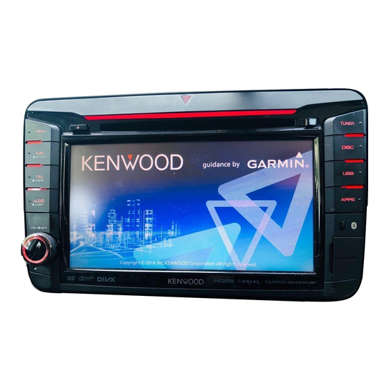
Kenwood DNX5350BT Instruction Manual
Hide thumbs
Also See for DNX5350BT:
- Quick start manual (36 pages) ,
- Instruction manual (129 pages) ,
- Firmware upgrade manual (1 page)

Related Manuals for Kenwood DNX5350BT


Summary of Contents for Kenwood DNX5350BT
- Page 1 GPS NAVIGATION SYSTEM DNX5350BT DNX5350DAB DNX535VBT GPS NAVIGATION INSTRUCTION MANUAL © IM382_Nav_X_En_00...
-
Page 2: Table Of Contents
Contents Navigation End-User License Agreements Starting a Route Previewing Multiple Routes Following a Route Getting Started Using the Navigation Map Using the Navigation System Adding a Point to a Route Help When You Need It Taking a Detour Searching Help Topics Stopping the Route Status Bar Icons Using Suggested Routes... - Page 3 Using the Apps Customizing the Settings About Smartphone Link Customizing the Navigation System Downloading Smartphone Link Changing the Map Settings Connecting to Smartphone Link Enabling Maps Sending a Location from Your Phone Changing the Navigation Settings Disabling Calls While Connected Adjusting the Display Settings About Garmin Live Services Route Preferences...
-
Page 4: End-User License Agreements
Software License Agreement under copyright laws and international copyright treaties. The Garmin Products are licensed, not BY USING THE DNX5350BT/DNX5350DAB/ sold. The structure, organization and code of DNX535VBT, YOU AGREE TO BE BOUND BY THE the Software and Application are valuable trade TERMS AND CONDITIONS OF THE FOLLOWING secrets of Garmin and/or its third-party providers. - Page 5 otherwise connected to or in communication for solely personal use, or if applicable, for use with vehicles, and which are capable of dispatch, in your business’ internal operations, and not for service bureau, time-sharing, resale or other fleet management or similar applications where the Content is used by a central control center in similar purposes.
- Page 6 End-User License Agreements Content from its third party content supplier, companies of Garmin and its licensors, DISCLAIM whichever of the three periods is shortest. A ANY WARRANTIES, EXPRESS OR IMPLIED, OF Garmin device’s “useful life” means the period QUALITY, PERFORMANCE, MERCHANTABILITY, during which the device (a) has the required FITNESS FOR A PARTICULAR PURPOSE OR technical capabilities to utilize the then-current...
- Page 7 OWN DISCRETION AND RISK. YOU WILL BE manufacturer, supplier or otherwise does not SOLELY RESPONSIBLE FOR ANY DAMAGE TO YOUR necessarily constitute or imply its endorsement, ELECTRONIC COMMUNICATION DEVICE OR ANY sponsorship or recommendation by Garmin or LOSS OF DATA THAT MAY RESULT FROM THE its licensors.
- Page 8 finds that you have violated any of the terms of conflict of laws provisions, or (ii) the United Nations this Agreement. In addition, this Agreement shall Convention for Contracts for the International Sale terminate immediately upon the termination of of Goods, which is explicitly excluded. You agree an agreement between Garmin and any third to submit to the jurisdiction of Kansas for any and party from whom Garmin (a) obtains services...
- Page 9 application of the Nokia Terms of Service at http:// here.com/services/terms and the Nokia Privacy Policy at http://www.nokia.com/global/privacy/ privacy/policy/privacy-policy/. English...
-
Page 10: Getting Started
Getting Started The first time you use your Kenwood Navigation System, you need to set up your system. The Help menu provides additional information. Help When You Need It WARNING See "Safety Precautions and Important Information" Select Apps > Help to view information in the Quick Start Guide for product warnings and about using the device. -
Page 11: Satellite Signals
Adding a Shortcut Satellite Signals You can add shortcuts to the Where To? menu. A After your vehicle is turned on, the navigation shortcut can point to a location, a category, or a system begins acquiring satellite signals. The search tool. The Where To? menu can contain up to system may need a clear view of the sky to acquire 36 shortcut icons. -
Page 12: Finding Locations
Finding Locations The navigation system offers many methods for finding locations. The detailed maps loaded in your navigation system contain locations, such as restaurants, hotels, and auto services. You can use categories to browse for nearby businesses and attractions. Finding a Location by Category Enter a search term. -
Page 13: Finding An Address
Finding an Address Finding an Intersection Before you can find an intersection, you must ⁄ add a shortcut to the intersection search tool • The order of the steps may change depending on the (page 11). map data loaded on your device. Select Where To? > Intersections. Select Where To? > Address. Select a state or province. -
Page 14: Finding A Location Using Coordinates
Finding Locations Finding a Location Using Coordinates Select an option: Before you can find a location using coordinates, • Select a location marker. you must add a shortcut to the coordinates • Select a point, such as a street, intersection, or search tool (page 11). -
Page 15: Going Home
Going Home Select an area on the map. Select Where To? > Go Home. The address of the location appears at the bottom of the screen. Editing Your Home Location Information Select the location description. Select Where To? > Saved > Home. Select Set Location. -
Page 16: Starting A Route To A Saved Location
Finding Locations Starting a Route to a Saved Location Assigning Categories to a Saved Location You can add custom categories to organize your Select Where To? > Saved. saved locations. ⁄ If necessary, select a category, or select All Saved Places. • Categories appear in the saved locations menu after you have saved more than 12 locations. -
Page 17: Navigation
Navigation You can create, customize, and edit your routes. Starting a Route Using the Navigation Map Search for a location (page 12). From the main menu, select View Map. Select a location. If the zoom controls are hidden, select the map to display the zoom controls. -
Page 18: Adding A Point To A Route
Navigation Adding a Point to a Route Using Suggested Routes Before you can use this feature, you must save at While navigating a route, select least one location and enable the travel history return to the main menu. feature (page 15). -
Page 19: Navigating To An Exit
Navigating to an Exit Adding a Custom Avoidance Area Custom avoidances allow you to avoid specific From the map, select > Exit Services > areas and sections of road. You can enable and disable custom avoidances as needed. Select Go!. Select Settings >... -
Page 20: Deleting Custom Avoidances
Navigation Deleting Custom Avoidances Select Settings > Navigation > Custom Avoidances. Select an option: • To delete all custom avoidances, select • To delete one custom avoidance, select the avoidance, and select > Delete. Enabling Advanced Detours Select Settings > Navigation > Advanced Detours. -
Page 21: The Map Pages
The Map Pages You can customize which data appear on the map and view upcoming turns and current location information. Customizing the Map Layers Changing the Map Perspective You can customize which data appear on the Select Settings > Map & Vehicle > Driving map, such as icons for points of interest and road Map View. -
Page 22: Viewing A List Of Turns
The Map Pages Viewing a List of Turns Highway Mode When you are navigating a route, you can view all When navigating a route on a highway, a list of of the turns and maneuvers for your entire route upcoming exits automatically appears to show and the distance between turns. -
Page 23: Viewing Trip Information
Viewing Trip Information Finding Nearby Services The trip information page displays your present You can use the Where Am I? page to find nearby speed and provides statistics about your trip. services, such as hospitals or police stations. From the map, select >... -
Page 24: Using The Apps
Before you can connect to Smartphone Link, you must download and install the Smartphone Link application on your phone. Start Smartphone Link on your phone. See your other Kenwood system manuals and your phone owner's manual for connection information. appears in the status bar on your device when Smartphone Link is connected. -
Page 25: About Garmin Live Services
About Garmin Live Services About ecoRoute Before you can use Garmin Live Services, your The ecoRoute™ feature calculates your vehicle device must be connected to a supported phone fuel economy, carbon footprint, and the fuel price (page 24). running Smartphone Link of navigating to a destination, and offers tools for improving fuel efficiency. -
Page 26: Taking The Ecochallenge
Using the Apps Taking the ecoChallenge Viewing Your Fuel Economy The ecoChallenge helps you maximize your fuel Select Apps > ecoRoute™ > Fuel Economy. economy by scoring your driving habits. The higher your ecoChallenge scores, the more fuel The graph along the bottom shows your you save. -
Page 27: Exporting A Mileage Report
Planning a Trip You can use the trip planner to create and save a Connect a USB mass storage device to your trip with multiple destinations. Kenwood unit. Select Apps > Trip Planner. Select Apps > ecoRoute™ > Mileage Report. -
Page 28: Editing A Trip Itinerary
Using the Apps Editing a Trip Itinerary Using the World Clock Select Apps > Trip Planner. Select Apps > World Clock. Select a saved trip. If necessary, select a city, enter a city name, and select Done. Select an option: Viewing the World Map • To change the arrival or departure time, select a location in the trip. -
Page 29: Customizing The Settings
Customizing the Settings You can customize the settings of your GPS navigation system. Customizing the Navigation System Changing the Navigation Settings Select Settings. Select Settings > Navigation. • Calculation Mode—sets route preference. Select a setting category. • Avoidances—sets road features to avoid on a route. • Custom Avoidances—allows you to avoid specific roads Select the setting to change it. -
Page 30: Updating The Time Settings
Customizing the Settings Updating the Time Settings Restoring Settings You can restore a category of settings or all Select Settings > Units & Time. settings to the factory default values. • Current Time—select Automatic to update the time Select Settings. automatically. -
Page 31: Appendix
Before you can update the navigation system WARNING software, you must have a USB mass storage Garmin and JVC KENWOOD are not responsible for device and an Internet connection. the accuracy of, or the consequences of using, a safety camera database. -
Page 32: Custom Pois (Points Of Interest)
WARNING Garmin and JVC KENWOOD are not responsible for the consequences of using custom POI databases, or for the accuracy of custom POI databases. After downloading your POI database, use the Garmin POI Loader to install the POIs onto a USB mass storage device. - Page 33 English...
- Page 34 For the latest free software updates (excluding map data) throughout the life of your Garmin products, visit the Garmin Web site at www.garmin.com/Kenwood. © 2014 Garmin Ltd. or its subsidiaries Garmin International, Inc. 1200 East 151st Street, Olathe, Kansas 66062, USA Garmin (Europe) Ltd.